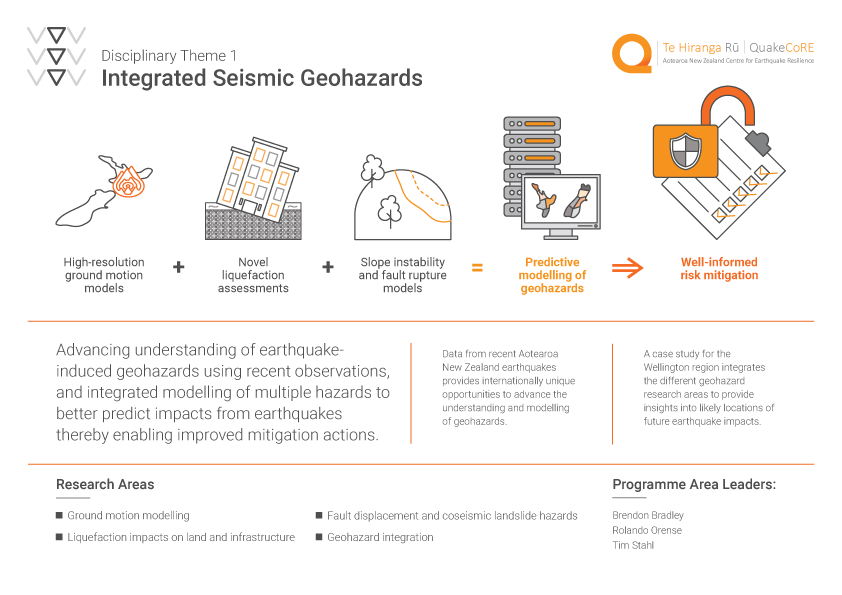
Advance understanding and modelling of individual earthquake-induced geohazards (ground motions, liquefaction, and slope instability), as well as unified data collection and modelling approaches to enable an integrated prediction in order to more efficiently mitigate future impacts and stimulate rapid advances in the profession.
Research Summary
Earthquake-induced ground motions, liquefaction, and other geohazards (e.g., surface fault rupture and landsliding) are primary causes of damage and disruption to the built and natural environments. An improved fundamental understanding of such phenomena, and subsequent improvements in predictive capability are essential to understanding the impacts of seismic events on rural and urban infrastructure. The recent 2010-2011 Canterbury and 2016 Kaikōura earthquakes have aptly illustrated significant ground motions and near-surface site amplifications; extensive liquefaction of land and damage to over 8000 residential homes in Christchurch, and port facilities in Wellington; and landslides and slope instability in Christchurch’s Port Hills and the State Highway 1 road and rail network on the Kaikōura coastline causing closure for over 1 year. Datasets and consequent knowledge amassed by QuakeCoRE researchers and their collaborators provide internationally-unique opportunities toward advances in understanding and modelling these geohazards individually, as well as unified data collection and modelling approaches to enable integrated predictions to more efficiently mitigate future impacts.
Research Outline
1. Ground-motion modelling
Activities within strand 1 are framed around six key themes that collectively enable simulation-based ground-motion modelling with high predictive capability and precision.
1.1. Development and refinement of ground motion simulation methods that enable the generation of acceleration time series for the seismic response analysis of infrastructure.
1.2. Development of ‘velocity models’ of the earth’s crust in new regions of New Zealand, or improvements in existing regions.
1.3. Develop, validate, and apply models for nonlinear near surface site and topographic response for use in conjunction with ground motion simulation methods.
1.4. Utilize ground motion simulations to forecast the severity of ground shaking over spatially-distributed regions in future major New Zealand earthquakes
1.5. Examination of modelling uncertainties in ground motion simulation methods and utilization for probabilistic seismic hazard analysis.
1.6. Explore the role of simulated ground motions for use in seismic response analysis of engineering infrastructure, including comparisons with as recorded ground motions and development of procedures for simulated ground motions in infrastructure seismic design guidelines.
2. Liquefaction impacts on land and infrastructure
The research activities in this strand 2 comprise new approaches and methodologies designed to assess and quantify the impacts of soil liquefaction on land and infrastructure through: (a) fundamental understanding of the onset and effects of liquefaction; and (b) application of these methods to assess, and possibly minimise, its impact to the built environment. These projects involve developing and using novel field, laboratory, and numerical tools and methods for evaluating liquefaction hazards and assessing their impacts on infrastructure, with emphasis on NZ-specific soils. The specific key themes are:
2.1. Advancement of Liquefaction Assessment
2.2. Historical Evidence of NZ Liquefaction
2.3. Dynamic Characterisation of Natural Pumiceous Deposits
2.4. Tools and Procedures for Seismic Effective Stress Analysis
3. Surface rupture and slope stability
Projects within this strand 3 have two primary aims: (i) improve current understanding of hazards and risks associated with fault surface rupture and coseismic slope instability and (ii) develop and apply state-of-the-art fault rupture and landslide models. Both aims are linked by a focus on utilising high-resolution topography, remote sensing, and machine-learning approaches; integration with available HPC resources will assist with the high computational demand of the projects. Specific themes are:
3.1. Empirical data on fault surface ruptures in New Zealand
3.2. Slope stability
3.3. Improved simulation of fault displacement geohazards
4. Geohazard integration
The aim of this fourth strand of the programme is to pursue targeted activities that lead to direct integration of the different sub-disciplinary strands 1-3. A case study focus on the Wellington region will be undertaken in order to provide a geographical context in which integration occurs naturally.
4.1: Explicit site response analysis in simulations of historical and future earthquakes in Wellington
4.2: Ground motion and slope instability modelling, including topographic amplification, in Wellington
4.3: Spatially-distributed prediction of geohazards along the Wellington Transportation corridor
Our people
Programme Leaders: Brendon Bradley, Rolando Orense, Tim Stahl
Researchers: Sarah Barrett, Jeff Bayless, Gabriele Chiaro, Kim de Graaf, Chris de la Torre, David Dempsey, Michael Drayton, Clark Fenton, Jeff Fraser, Matt Gerstenberger, Andy Howell, Robert Langridge, Robin Lee, Nicola Litchfield, Chris Massey, Samuel McColl, Christopher McGann, Gareth Morris, Aasha Pancha, Camilla Penney, Didier Pettinga, Sean Rees, Romy Ridl, Thomas Robinson, Andreas Skarlatoudis, Paul Somerville, Timothy Stern, Mark Stirling, Andrew Stolte, Mark Stringer, Erin Todd, Sjoerd Van Ballegooy, Rick Wentz, Katherine Yates