
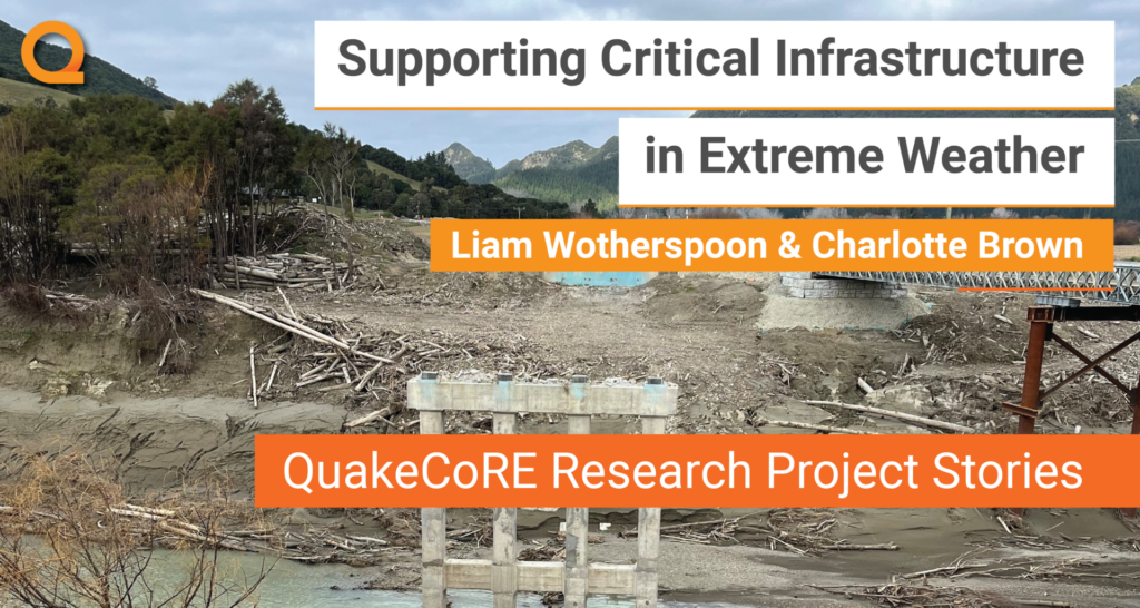
Research Project Stories – ShakeOut Together
October 16, 2023
QuakeCoRE Seminar – 10 November 2023
October 27, 2023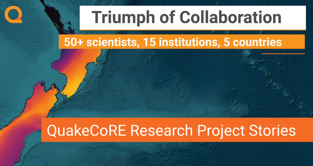

Triumph of Collaboration
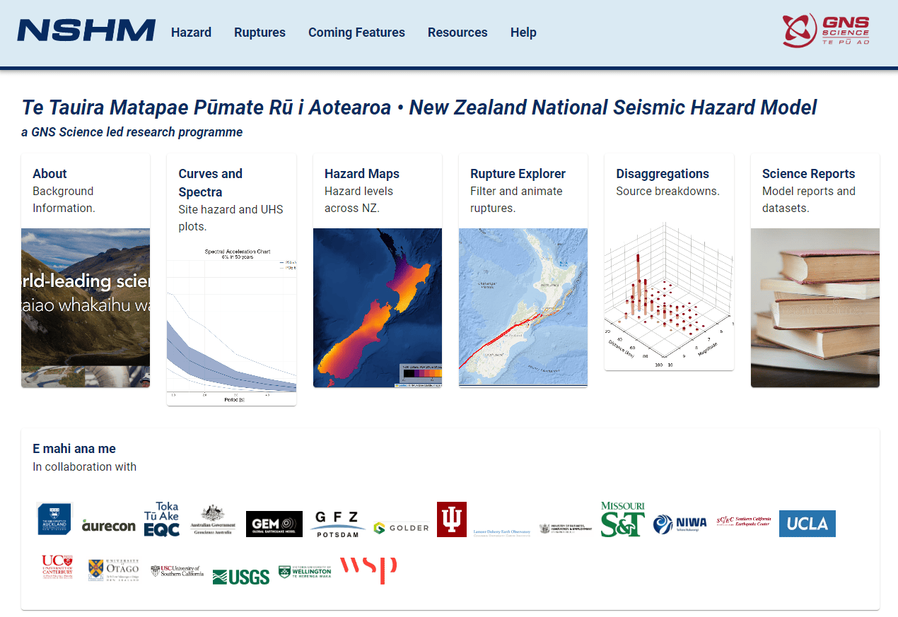
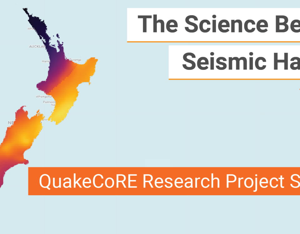
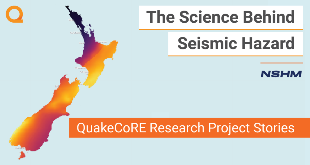
Aotearoa New Zealand’s best estimate for how much and how often the ground will shake in future earthquakes comes from Te Tauira Matapae Pūmate Rū i Aotearoa, the National Seismic Hazard Model (NSHM). A new version of the model was released in October 2022 showing, on average, a 50% increase in hazard over the previous model published a decade earlier. While we may not feel like celebrating the higher hazard, we can celebrate that we now have an up-to-date, state-of-the-art understanding of earthquake hazard across the country.
Led by GNS Science, and funded by the Ministry of Business, Innovation, and Employment and Toka Tū Ake EQC, this update to the NSHM was not a trivial piece of work. Given the increased understanding of earthquake science over the last decade, the development of new modelling techniques, improved computing capability, and the requirement for a robust, peer-reviewed process, there was a lot of work to do.
The solution lay in broad collaboration. Over 50 scientists from 15 institutions and 5 countries worked on the update with many New Zealand participants being Te Hiranga Rū QuakeCoRE investigators. This meant diverse research fields and leading-edge technology could be incorporated into the model alongside traditional approaches. A technical advisory group of engineers, policymakers, insurance brokers and scientists worked together to ensure the output was best available science and as useful as possible for end-users.
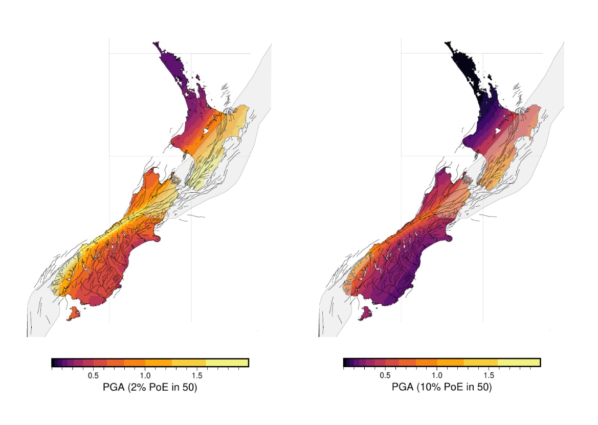
These maps show the strength of shaking and how likely it is that this level of shaking will occur within the next 50 years. The dark purple colours are weak shaking and the light orange and yellow colours are strong shaking. The scale bar shows peak ground acceleration (PGA) measured in g (1g is equal to gravitational acceleration on Earth). The thin black lines and grey shaded areas show the faults and subduction zones (respectively) that went into creating the model. LEFT: There is a 2% chance of experiencing this level of shaking in the next 50 years. RIGHT: There is a 10% chance of experiencing this level of shaking in the next 50 years.
The new NSHM is like the trunk of a tree. Below ground is an extensive network of roots – these are inputs like earthquake activity of different faults and how seismic waves shake the ground in different areas. Some of the inputs are models themselves, and have multiple dimensions of space, time, earthquake physics, and associated uncertainties.
Mathematical logic, and our understanding of earthquake occurrence, bring this intense tangle of roots into a coherent trunk to provide a rigorous estimate of seismic hazard that does justice to current knowledge.
The result is a nationwide increase in seismic hazard we can’t ignore. Regional breakdowns show most regions have either the same or an increased level of hazard, and some regions have twice to three times their previous level. The increase arises mainly from new ways of estimating how the ground surface will behave during earthquakes. Ground conditions have a big impact on level of shaking and can vary greatly within a city. Improved modelling of the Hikurangi subduction zone and complex earthquake sources have also contributed to the increase.
The many and varied uses of the NSHM form the canopy of the tree. The trunk feeds into the branches by informing engineering standards for buildings; guiding risk assessments for policy-making, insurance, land-use planning; supporting emergency management, business continuity planning, and community resilience. Let’s hope this NSHM update leads to a profusion of foliage so that earthquake mitigation measures keep pace with what we know of our seismic hazard.
While this new NSHM is already a triumph of collaboration, demonstrating world-leading approaches, its real success will lie in the actions taken towards Aotearoa New Zealand becoming a more earthquake-resilient nation.

The Disciplinary Theme (DT) & Inter-disciplinary Programme (IP) Research Programmes are comprised of non-contestable Coordinated Research Projects and contestable Research Projects funded under the Request for Proposals (RfP).
The Coordinated Projects are led by the Programme Area Leaders (PALs) and provide a strategic, long-term research framework for each of the research areas.
All researchers are encouraged to engage with these coordinated projects either through the QuakeCoRE website or by reaching out to the relevant Programme Area Leader(s).
Stay up-to-date with the QuakeCoRE monthly Newsletter