2023 Te Hiranga Rū QuakeCoRE Directors’ Award Winner: Roger Fairclough
September 22, 2023
Research Project Stories – Katherine Yates
October 4, 2023
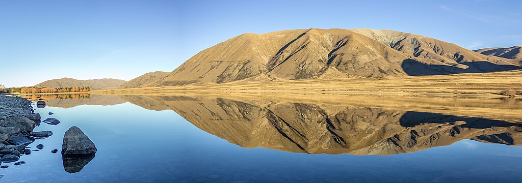
Mt. Harper reflecting on Lake Camp, Hakatere Conservation Park. Vishal Makwana, CC BY 2.0 , via Wikimedia Commons
The Mount Harper Earthquake
After a strong earthquake, there are usually a lot of questions we ask ourselves. How big was it? Where was the epicentre? Which fault caused it? Have there been earthquakes there previously, and will there be more?
A magnitude Mw5.6 earthquake (moment magnitudes from USGS and GeoNet, local magnitude ML6.0) occurred in the relatively remote Rangitata River valley at 9:14 am on Wednesday September 20th. The earthquake was felt widely across the South Island, which was in part due to its shallow hypocentral depth (~11 km) and sedimentary basin properties in the Canterbury Plains.
This quick blog post by Te Hiranga Rū QuakeCoRE researchers: Associate Investigator Camilla Penney, Programme Area Leader Tim Stahl, and Director Brendon Bradley summarises what we know about faults in the area and provides an overview of reconnaissance in the epicentral region.
Why would earthquakes happen here?
Aotearoa New Zealand sits astride the Australian-Pacific plate boundary, where ~40 mm per year of convergence causes faulting across the South Island. About 75% of this plate motion is accommodated by the Alpine fault and, at the latitude of South Canterbury, the remainder is primarily taken up by faults in the Pacific plate. A major zone of faults including the Ostler, Fox Peak, and Lake Heron faults have been considered ‘backthrusts’ of the Alpine Fault. They each accommodate about 1-2 mm per year of slip and have evidence of several M7+ earthquakes occurring over the last approximately 30 thousand years. Geologists can see the evidence for past earthquakes (including how big they are & how frequently they occur) preserved in the landscape. An example of a series of fault scarps from the Lake Heron Fault, which as little as 5-10 km away from the epicentre) is shown in Fig. 1.

Figure 1
Was this earthquake consistent with what we see in the geology?
In short, yes. The depth is consistent with historical seismicity in the region (Fig. 3). The fault’s NNE/SSW orientation, moderate to steep dip, and predominantly reverse sense is consistent with field mapping of faults at the surface (Fig. 4). It is important to note that this earthquake didn’t necessarily occur on a mapped or even known fault – the culprit is however very likely to be ‘genetically’ related to the surrounding faults in the same tectonic setting.

Figure 2: Relocated hypocentres for the central South Island (after Reyners et al. 2011). Yellow stars are for known, high-angle reverse mechanism earthquakes: 12011 MW 4.2 earthquake near the Ostler Fault (data available from USGS) at 4 km depth; 22004 MW 4.5 earthquake near the Fox Peak Fault (data available from GeoNet) auto-located at 2 km depth. (from Stahl, 2014)


Figure 3: These ‘beachball diagrams’ show the orientation, geometry, and slip sense of the fault(s). The image from the left contains the solutions for the earthquake from the USGS, GeoNet and Geofon; the image on the right is from field mapping along the Fox Peak fault by Stahl et al. (2016). Both show evidence for motion on steeply to moderately dipping reverse faults with a minor component of strike-slip.
Will there there be more earthquakes?
Regardless of the exact fault, the overall rates of large earthquakes in this region are low. This earthquake stressed the surrounding rock mass, and may have increased stress on nearby major faults, and so aftershocks are anticipated. It is difficult to say if this event could cause a larger earthquake nearby; it is a possibility but it remains unlikely.
How strong was the ground-shaking produced?
A seismic instrument located at Rata Peak was almost immediately above the epicentre and recorded a ground motion with a peak ground acceleration (PGA) on the order of 0.63g and peak ground velocity (PGV) of 13 cm/s. Thus, the ground shaking immediately above the fault was easily significant enough to cause instability of steep slopes (as discussed further below).
Populated regions nearby in Peel Forest and Mount Somers, both on the edge of the Canterbury Plains, had ground motions with PGA of approximately 0.05g, and PGV of approximately 4 cm/s. For comparison, ground motions in central Christchurch during the 2011 Feb 22 earthquake were approximately PGA=0.4-0.5g and PGV=40-60cm/s.
3D ground-motion simulations of the event, performed on high-performance computers by Te Hiranga Rū QuakeCoRE Disciplinary Theme 1 (DT1) researchers, illustrate the significant reverberations of the ground shaking in the Canterbury Plains and Mackenzie Basin, which people would feel as a longer-period ‘rolling’ type of shaking.
What were the effects of the mainshock?
University of Canterbury geologists Camilla Penney, Tim Stahl, Kate Pedley, Giles Ostermeijer, and Jade Humphreys undertook a reconnaissance trip to investigate possible surface rupture and slope stability issues around the Rangitata Valley. There was no evidence of surface rupture on mapped faults, which is consistent with the event’s small magnitude and minor displacements, but further reconnaissance should be undertaken to confirm the lack of surface rupture. There was however significant rockfall (boulders up to 8 m3) in the epicentral region from a peak known as Rawtor. There was one report of a non-serious injury from rockfall nearby and some fences & roads were damaged.


UC geologists documenting rockfall from Rawtor. The hillslope shows evidence for fresh rockfall from this event (light grey area near summit) and in past events (debris cone and old rockfall boulders near base of hillslope). Photo by Kate Pedley (University of Canterbury)
Rockfall boulders at the base of Rawtor. Lighter colours indicate ‘fresh’ rock faces from boulders that dislodged during this event. Old rockfall boulders are also present. There are impact divots on the unvegetated hillslope in the top left, indicating the trajectory of one of the fresh boulders. Photo by Kate Pedley (University of Canterbury).
Where to from here?
University of Canterbury geologists are going to continue reconnaissance for possible fault rupture and landslides over the weekend. Te Hiranga Rū QuakeCoRE and GNS seismologists are going to continue to refine the locations and characteristics of this event. The combination of prior information regarding the geology, secondary effects from the event, and geophysics allow scientists to provide information to locals regarding seismic geohazards in this and future events.


